A place to grow your relationship with God

Archive for the ‘Facts about Countries’ Category

Mayan Food and Culture

The Ancient Maya had a rich and diverse food culture. They ate many different things, including food from the sea, plants, and animals. They got their food by hunting, gathering, and large-scale farming. The most important plant they grew was maize, also known as corn.

Much of the ancient Maya’s food came from their farms and special “forest gardens.” These gardens were called pet kot. The name comes from the circular stone walls that often surrounded them.

The Maya used clever farming methods to keep their soil healthy. One method was called slash-and-burn farming. This meant clearing land and burning plants. The ash from the burning helped make the soil richer for a short time. This method is still used in some areas today. They also used crop rotation to keep the soil fertile and grow different kinds of food.

Many foods and cooking methods from the ancient Maya are still used today. They are popular with modern Mayan people and have spread all over the world.

What Plants Did the Ancient Maya Eat?

Different types of maize or corn.

Scientists study old plant remains to learn about ancient Maya food. They find tiny bits of plants in the soil from old Maya sites. These studies show what plants the Maya grew and gathered.

Early plant findings come from a place called Cuello, in Belize. Most of the plant discoveries are from later periods. These show that the Maya ate both wild and farmed plants. Important sites like Cobá, Cerén, and Tikal give us clues. They also show how diets changed based on where people lived. For example, people near the coast ate more seafood.

The ancient Maya’s main foods were four farmed crops. These were maize (corn), squash, beans, and chili peppers. Corn, squash, and beans are sometimes called the “Three Sisters.” They provide important nutrients when eaten together.

Corn was the most important food for the ancient Maya. It was also very special in their stories and beliefs. They prepared corn in a special way called nixtamalization. This process involved soaking and cooking corn in a special water mixture. This helped release a vitamin called niacin. Niacin is important for health and prevents a disease called pellagra.

After nixtamalization, corn was ground into dough. This dough was used to make many dishes. Tortillas were common. They were cooked on a flat griddle called a comal. Tortillas were used to wrap other foods like meat and beans. Tamales were another popular dish. They were made from corn dough, often with a filling. Tamales were wrapped in corn husks and steamed.

The Maya also made liquid dishes from corn. Atole was a thick corn drink. Pozole was a soup with large corn grains, often in turkey broth. They added chili peppers, cacao, wild onions, and salt to these dishes for flavor.

Besides corn, beans, and squash, the Maya ate other plants. They grew fruits like tomatoes, avocados, guavas, papayas, and pineapples. They also grew vegetables like sweet potatoes and Xanthosoma. Chaya leaves and chayote fruit were also part of their diet.

Many herbs and spices were used too. These included vanilla, epazote, achiote (annatto seed), and allspice.

Maya farmers used different techniques to grow their crops. These included building terraces, raised fields, and using irrigation. Some fields were close to homes, while others were farther away.

What Meats Did the Ancient Maya Eat?

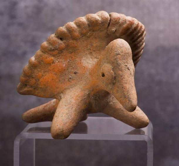
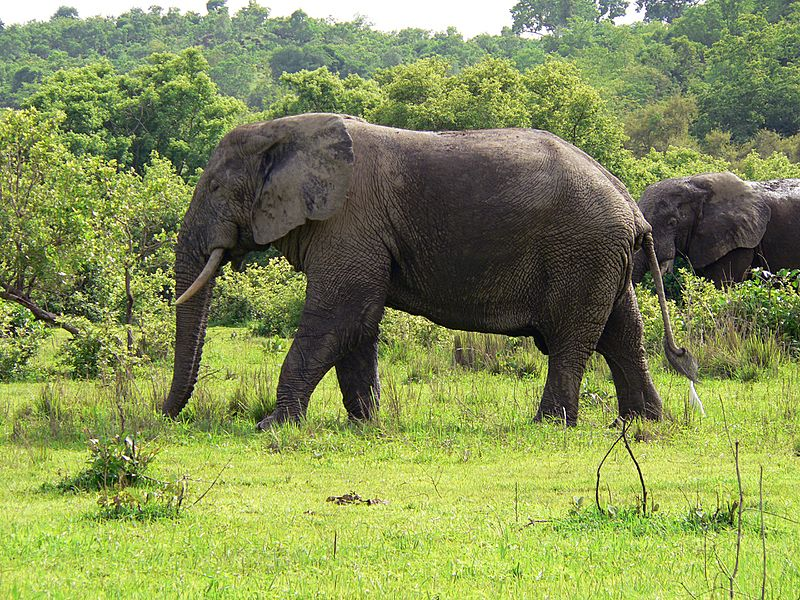
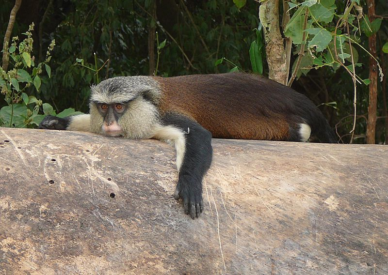
The ancient Maya got most of their meat from hunting. They also kept some animals like dogs and turkeys. Animals they hunted included deer, armadillos, tapirs, peccarys, and monkeys. They also ate different kinds of fowl, turtles, and iguanas. Most of their meat came from white-tailed deer.

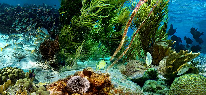
People living near the coast also ate a lot of seafood. This included fish, lobster, shrimp, and shellfish like conch.

Scientists have studied animal bones found at Maya sites. These bones show what animals were eaten. For example, at sites like Lamanai, deer were always important. But over time, the Maya started eating more small mammals, birds like turkey, and seafood.

Even Maya cities far from the ocean ate seafood. At a site called Caracol, in the mountains, scientists found remains of marine animals. This suggests that the Maya brought live seafood, like stingrays and fish, from the ocean up the rivers.

Ancient Maya Food Today

Many foods and cooking styles from the ancient Maya are still enjoyed today. Their food traditions began as early as 1500 BC. With corn as a main food, the Maya learned to grow and use many other ingredients. This led to new Maya dishes that are now popular across the Americas.

Today, foods like chocolate, avocado (guacamole), tortillas, and tamales are eaten far beyond the Maya region.

Common cocoa seeds, used to make hot chocolate.

Chocolate: The cocoa tree grows naturally in Maya lands. The Maya were likely the first to grow the cacao plant for food. For them, cocoa was a special gift from the gods. The word theobroma, which is the cocoa plant’s scientific name, means “food of the gods.”

Cacao beans were even used in ceremonies for the Mayan gods. All Maya people, rich or poor, enjoyed cocoa. Maya couples drank chocolate during weddings.

Cocoa beans were ground and mixed with chili peppers, cornmeal, and honey. This made a drink called xocolatl. Only the wealthy could drink this. This ancient Maya chocolate drink was different from today’s hot chocolate. It was often unsweetened and had a frothy texture.

Avocado/Guacamole: Avocados came from southern Mexico and Guatemala. They became a key part of Maya cooking. Avocado trees grow well in warm, humid places, like where the Maya lived. Avocados are used in many modern dishes. Their smooth texture and rich taste make them a popular snack.

Corn Tortillas: Corn is very important in Maya culture and stories. The Maya creation story, the Popol Vuh, says that the first humans were made from corn dough.

Tortillas, made from corn, were a common food for everyone. Ancient Maya tortillas were smaller, about three to four inches wide. They were also thicker than today’s tortillas. This made them a strong base for other foods, like meat and avocado.

Today’s tortillas are thinner and often larger. They are used in many dishes like tacos, burritos, quesadillas, and chips.

Tamales: Tamales are made from corn dough, often with meat and vegetables inside. They were easy to carry, making them a convenient food. Like many Maya dishes, tamales were wrapped in corn husks for cooking. After cooking, the tamal was unwrapped and sometimes topped with salsa.

Tamales were often served at Maya celebrations. Maya women would also sell fresh tamales, sometimes trading them for cocoa seeds. Old Maya art and paintings show tamales often. Modern tamales are enjoyed in much the same way as they were long ago.

source: Ancient Maya cuisine facts for kids Kids Encyclopedia Facts

Exploring Ancient Maya Musical Instruments

Mayan Music
The Indian civilizations of South and Central America had a vibrant musical heritage. The Mayas used a variety of wind and percussion instruments, such as flutes, whistles, trumpets, rattles, bone and gourd rasps, and drums. These instruments are mentioned in texts and illustrated in Maya art. Among the most fascinating discoveries is the Maya whistle.

Maya bird whistle made around 1000 AD. Credit: William Scott / Source: BigStockPhoto

A whistle flute, sometimes called a fipple flute, is a flute blown from the end. Air is sent through a simple mouthpiece against the sharp edge of a hole cut in the pipe below the mouthpiece. It was often made of clay or wood. There is even an example of one made from bird bones. Finger holes make more than one pitch possible. Whistle flutes were common.

Ocarinas are flutes in the shape of animals. The word ocarina comes from the Spanish, who settled in the Central American country of Costa Rica, rich in rainforest animals.

The ancient inhabitants of Costa Rica crafted ocarinas that represented birds, armadillos, owls, bats, tapirs, monkeys, and other rainforest creatures.

Today, modern Latin American artists make ocarinas inspired by the ancient ones. The instruments are played by blowing in the small hole at the end, covering the four holes on the body with your fingers, and leaving the large hole at the end uncovered.

When fingers are lifted off any of the four holes on the body, varying sounds are created. The sounds made are similar to the calls of Costa Rican birds.

Explore Country Facts Organized by Continent

Below you will find links to facts about various countries. The countries are organized by continent. This page is a work in progress.

North Pole

Europe

Middle East

Australia

North America

South America

Antarctica

Facts about the Netherlands for Children

The Netherlands is a country that is part of the Kingdom of the Netherlands. Most of it is in Western Europe, but some parts are in the Caribbean. Over 17 million people live there. To the north and west of the European part is the North Sea. Germany is to the east and Belgium is to the south. The Netherlands helped start the European Union. People from the Netherlands are called “Dutch”. Their language is also called Dutch. The official capital is Amsterdam, but the government is in The Hague.

Geography and Landscape

The European Netherlands covers about 41,543 square kilometers, including water. The land area is about 33,481 square kilometers. The Caribbean Netherlands is much smaller, about 328 square kilometers.

Relief map of the European Netherlands

The Netherlands is a very flat country. About 26% of its land and 21% of its people are below sea level. In the southeast, there are some small hills, but they are not very high. Most of the land below sea level was created by digging up peat or by reclaiming land from the water. Since the 16th century, large areas called polders have been kept dry using dikes, canals, and pumps

Nature and Wildlife

Underwater life of Klein Bonaire

The Netherlands has 21 national parks and hundreds of other nature reserves. Most are managed by Staatsbosbeheer (the national forestry and nature group) and Natuurmonumenten (a private group). The Wadden Sea in the north has tidal flats and wetlands. It is rich in different kinds of life and is a UNESCO World Heritage Nature Site. The Eastern Scheldt became a national park in 2002. It is the largest national park in the Netherlands.

Common seals on Terschelling, a Wadden Sea island

The Netherlands has lost most of its original natural woods. They were cut down by 1871. Nitrogen pollution is a problem. The number of flying insects in the Netherlands has dropped by 75% since the 1990s.

People and Language

The Netherlands is a small country with many people. It is one of the most densely populated countries in the world.

Most people speak Dutch. In Friesland, about 200,000 people speak Frisian. Frisian is very similar to English. Some Dutch people speak dialects. The Saxon dialects in the northeast are somewhat like Low German.

A 2006 survey showed that 25% of Dutch people are Christian. 3% follow other religions like Judaism, Islam, or Hinduism. 26% are “unbounded spiritual” (have their own beliefs). The other 44% are not religious.

Source: Kids Encyclopedia Facts

Facts about China for Children

China, also known as the People’s Republic of China (PRC), is a huge country in East Asia. It has a population of over 1.4 billion people, making it the second-most populated country in the world, after India. China is also the third-largest country by land area, covering nearly 9.6 million square kilometers. It stretches across five time zones and shares borders with fourteen other countries.

China is divided into 33 main areas, including provinces, autonomous regions, and cities. Beijing is the capital city, and Shanghai is its largest city by population and a major financial hub. China is considered one of the world’s first “cradles of civilization,”

China’s Geography

East Asia topographic map


China has a very diverse landscape. In the north, you’ll find dry deserts like the Gobi Desert. In the south, there are lush subtropical forests. Major mountain ranges like the Himalayas separate China from its southern neighbors.

The Yangtze River and Yellow River are two of the world’s longest rivers. They flow from the Tibetan Plateau to the eastern coast, where many people live. China’s coastline along the Pacific Ocean is very long, with different seas like the Yellow Sea and South China Sea.

The world’s highest point, Mount Everest, is on China’s border with Nepal. The lowest point is Ayding Lake, which is below sea level.

Climate and Environment

China’s climate is mostly affected by dry seasons and wet monsoons. This means there are big temperature differences between winter and summer.

Köppen-Geiger climate classification map for mainland China

One big environmental challenge is the expansion of deserts, especially the Gobi. China has planted many trees to help stop sandstorms. Water pollution and air pollution are also major concerns. China is working to reduce pollution and has invested a lot in renewable energy. It’s the world leader in making and using renewable energy technologies.
The Three Gorges Dam is the largest hydroelectric dam in the world.

The Three Gorges Dam is the largest hydroelectric dam in the world.


China is the world’s largest producer of many crops, including rice and wheat. It has a climate that is very good for farming.

Amazing Animals and Plants

A giant panda, China’s most famous endangered and endemic species, at the Chengdu Panda Base in Sichuan.

Giant Panda Eating

China is one of the most biodiverse countries in the world, meaning it has a huge variety of animals and plants. It’s home to many mammals, birds, reptiles, and amphibians.

Some famous animals include the giant panda, which is an endangered species found only in China. Many animal species are threatened due to human activities like habitat loss. China has created many nature reserves to protect its wildlife.

China also has over 32,000 types of plants. You can find cold coniferous forests in the north and subtropical forests in the south. Tropical rainforests in areas like Yunnan are home to a quarter of all China’s animal and plant species.

Flag of the People’s Republic of China
National Emblem of the People’s Republic of China

Source: Kids Encyclopedia Facts

History of France for Children

History of France
The name “France” comes from the Latin word Francia. This means “land of the Franks”. The borders of modern France are similar to ancient Gaul. Celtic Gauls lived in Ancient Gaul.

Julius Caesar conquered Gaul for Rome in the 1st century BC. The Gauls then started speaking Latin, which later became the French language. Christianity became popular in France by the 4th and 5th centuries.

Map France 1477-fr


France in 1477. The red line shows the Kingdom of France. Light blue is the royal land.
In the 4th century AD, Germanic tribes, especially the Franks, invaded Gaul. This is when the name Francie appeared. The Franks were the first European tribe after the Roman Empire fell to become Christian.

The Treaty of Verdun in 843 split Charlemagne’s large empire into three parts. Western Francia was the biggest part, and it is similar to modern France.

The Carolingian dynasty ruled France until 987. Then, Hugh Capet became King. His family, including the Capetians, the House of Valois, and the House of Bourbon, united the country. They did this through many wars and family inheritances.

The monarchy was strongest in the 17th century under King Louis XIV. At that time, France had the largest population in Europe. It had a big impact on European politics, economy, and culture. French became the language used for diplomacy between countries. Many new ideas from the Enlightenment came from France. French scientists also made important discoveries in the 1700s. France also gained many lands overseas in the Americas, Africa, and Asia.

Louis XIV, known as the “Sun King”, was the absolute ruler of France. He made France the most powerful country in Europe.
France was a monarchy until the French Revolution in 1789. King Louis XVI and his wife, Marie Antoinette, were executed in 1793. Many other French citizens were also killed. Napoleon Bonaparte took control in 1799. He later made himself Emperor of the First Empire (1804–1814). His armies conquered most of Europe. The metric system was created by French scientists during the French Revolution.

After Napoleon’s defeat in 1815 at the Battle of Waterloo, another monarchy started. Later, Louis-Napoléon Bonaparte created the Second Empire in 1852. He was removed after France lost the Franco-Prussian War in 1870. The Third Republic then took over.

In the 19th century, the large French colonial empire included parts of West Africa and Southeast Asia. France influenced the culture and politics of these areas. Many former colonies still speak French today.

France was a major battleground in both the First and Second World Wars. During the First World War, millions died in the trenches. Over a million died in the Battle of the Somme alone. Conditions were very bad.

During the Second World War, Nazi forces took over France. The Allies landed in Normandy on June 6, 1944. This started the Battle of Normandy. German forces lost control of France in just a few months.

source: France facts for kids Kids Encyclopedia Facts

Facts about Afghanistan for Children

Afghanistan, officially known as the Islamic Emirate of Afghanistan, is a country that doesn’t have a coastline. It’s located where Central Asia and South Asia meet. People sometimes call it the “Heart of Asia.” It shares borders with Pakistan, Iran, Turkmenistan, Uzbekistan, Tajikistan, and China.

Afghanistan covers about 652,864 square kilometers (252,072 square miles). Most of the country is mountainous, especially with the Hindu Kush mountain range. There are also flatter areas in the north and southwest. Kabul is the biggest city and the capital. In 2021, Afghanistan’s population was around 40.2 million people. It’s made up of many different ethnic groups, like Pashtuns, Tajiks, Hazaras, and Uzbeks.

Afghanistan Geography

Afghanistan is in Southern-Central Asia. It’s often called the “crossroads of Asia” or the “Heart of Asia.” A famous poet once wrote that Afghanistan is like the heart of Asia. If Afghanistan is in trouble, Asia is in trouble. If Afghanistan is peaceful, Asia is peaceful.

Afghanistan is about 652,864 square kilometers (252,072 square miles). This makes it the 41st largest country in the world. It’s a bit bigger than France. Since it’s landlocked, it has no coastline. Its longest border is with Pakistan. It also borders Tajikistan, Iran, Turkmenistan, Uzbekistan, and China.

Mountains, Plains, and Rivers

The mountainous topography of Afghanistan


Afghanistan’s land is mostly mountainous and rugged. The Hindu Kush mountain range runs through it. This range is part of the Himalayas. Most of the highest points are in the east. These areas have fertile mountain valleys. The Hindu Kush ends in the west-central highlands. This creates plains in the north and southwest. These plains have grasslands, semi-deserts, and hot, windy deserts. Forests are found in some eastern provinces. The highest point is Noshaq, which is 7,492 meters (24,580 feet) above sea level.

Even with many rivers and lakes, large parts of Afghanistan are dry. The Amu Darya river starts north of the Hindu Kush. Other rivers like the Hari Rud and Helmand River flow through the country. The Kabul River flows east towards the Indus River. In winter, the mountains get heavy snow. This melting snow fills the rivers and lakes in spring. However, two-thirds of Afghanistan’s water flows into neighboring countries.

Wildlife and Nature

The snow leopard is the official national animal of Afghanistan.

Many different animals live in Afghanistan. Snow leopards and brown bears live in the high mountains. The Marco Polo sheep is found only in the Wakhan Corridor. Foxes, wolves, and deer live in the mountain forests. In the northern plains, you can find birds, hedgehogs, and large meat-eaters like jackals.

Gazelles and wild pigs live in the southern and western plains. The Afghan Hound is a special dog breed from Afghanistan. It’s known for being fast and having long hair. Afghanistan also has unique animals like the Afghan flying squirrel and the Afghan snowfinch.

The forests have pine, spruce, and fir trees. Grasslands have short grass and shrubs. Colder, high-up regions have tough grasses and small flowering plants. Afghanistan has three national parks: Band-e Amir, Wakhan, and Nuristan.

Languages Spoken in Afghanistan

Dari and Pashto are the official languages. Many Afghans speak both. Dari is similar to Persian and is often used as a common language in Kabul and the northern parts of the country. Pashto is the main language of the Pashtuns. Many Pashtuns also speak Dari.

Other languages spoken include Uzbek, Turkmen, and Balochi. Many Afghans can also understand Hindustani (Urdu-Hindi). This is because of returning refugees from Pakistan and the popularity of Bollywood movies. English is also becoming more common.

Afghanistan’s Economy


Afghanistan’s economy is still developing. It has a lot of mineral resources, possibly worth over $1 trillion. But it remains one of the world’s least developed countries. This is due to its mountains, being landlocked, and ongoing conflict. The country imports more goods than it exports. Its main exports are fruits and nuts.

The Afghani (AFN) is the national money. The central bank is called Da Afghanistan Bank. Many local and foreign banks operate in the country.
Many Afghans who lived abroad have returned. They have helped the economy by starting businesses. Construction is a big industry. Major projects include new cities and towns. The telecom industry has also grown a lot, creating many jobs. Afghan rugs are also a popular export.

Source: Kids Encyclopedia Facts

Facts about Benin for Children

Benin (officially called the Republic of Benin) is a country in West Africa. Its capital city is Porto-Novo. However, the main center for government and the largest city is Cotonou. Most people in Benin live along the southern coast, near the Bight of Benin.

The official language of Benin is French. Other languages like Fon and Yoruba are also widely spoken. The main religions are Christianity (especially Roman Catholicism) and Islam. Some people also follow traditional faiths like Vodun.

Geography and Climate
Benin is a long, narrow country in West Africa. It stretches about 650 kilometers (400 miles) from the Niger River in the north to the Atlantic Ocean in the south. To its west is Togo, to the north are Burkina Faso and Niger, and to the east is Nigeria. The southern border is the Bight of Benin.

Benin has four main land areas from south to north:

A low, sandy coastal plain, which is marshy and has lakes.
Plateaus in southern Benin covered by Guinean forest-savanna mosaic, with altitudes between 20 and 200 meters (66 and 656 feet).
A flatter area with rocky hills, reaching up to 400 meters (1,300 feet) around Nikki and Save.
The Atacora mountain range in the northwest, which extends into Togo. The highest point is Mont Sokbaro, at 658 meters (2,159 feet).
Because much of Benin is low-lying and near the coast, it is vulnerable to climate change. Rising sea levels could affect people and the economy. Northern areas might also become more like deserts.

Benin has fields, mangroves, and some forests. In most of the country, you’ll find savanna with thorny bushes and baobab trees. Some forests grow along riverbanks. In the north, the Reserve du W du Niger and Pendjari National Park are home to African bush elephants, lions, antelopes, hippopotamuses, and monkeys. These parks are important places for lions in West Africa. The African wild dog used to live here but is now thought to be extinct in Benin.

The coastal area gets about 1300 mm (51 inches) of rain each year. Benin has two rainy seasons (April to July, and September to November) and two dry seasons (December to April, and July to September). Temperatures are warmer and more humid along the coast. In Cotonou, the average high temperature is 31°C (88°F).

As you move north towards the Sahel, the temperatures change more. A dry wind called the Harmattan blows from December to March. During this time, the grass dries, plants turn reddish-brown, and fine dust fills the air, making the sky look cloudy.

Government and Economy
Benin is a presidential republic. This means the President of Benin is both the head of the country and the head of the government. People vote for their leaders in a multi-party system. The government has executive power, meaning it carries out laws. The National Assembly has legislative power, meaning it makes laws. The courts are separate from the government and the legislature. This system is based on the 1990 Constitution of Benin.

Benin’s economy relies on farming for survival, growing cotton, and trade with nearby countries. Cotton is very important, making up 40% of the country’s total economic output (GDP) and about 80% of its official exports.

People and Culture
Benin, with a population of 13.7 million, has most of its people living in the southern region. The average life expectancy is 62 years. The country is home to around 42 African ethnic groups, including major ones like the Fon, Yoruba, Dendi, Bariba, and Fula. There are also communities from neighboring countries like Nigeria and Togo, as well as Lebanese, Indian, and European residents.

Arts and Music
Beninese literature has a strong history of oral storytelling. Felix Couchoro wrote the first Beninese novel, L’Esclave, in 1929. Famous artists from Benin include singer Angélique Kidjo and actor Djimon Hounsou, both born in Cotonou. Composer Wally Badarou and singer Gnonnas Pedro are also from Benin.

Religion
The two main religions in Benin are Christianity and Islam. In 2020, about 52.2% of people were Christian, and 24.6% were Muslim. About 17.9% follow traditional faiths, including local animistic religions and Vodun. The town of Ouidah on the coast is a spiritual center for Beninese Vodun.

Education
The ability to read and write (literacy rate) in Benin is one of the lowest in the world. In elementary schools, local languages are used for teaching, and French is introduced later. In high school, French is the only language used for teaching.

Food
Beninese food often includes fresh meals with different sauces. In southern Benin, corn dough is a common food, served with peanut or tomato-based sauces. People eat fish, chicken, beef, goat, and sometimes bush rat. In northern Benin, yams are a main food, also served with sauces. People in the north also eat beef and pork fried in palm or peanut oil, or cooked in sauces. Cheese is used in some dishes. Other foods include couscous, rice, beans, and fruits like mangoes, oranges, and pineapples.

Meals usually have less meat and more vegetable fat. Smoked fish is common. Corn flour is made into dough using grinders. “Chicken on the spit” is a popular dish where chicken is roasted over a fire. Some people use outdoor mud stoves for cooking.

Flag
Coat of Arms

Source: Benin facts for kids Kids Encyclopedia Facts

Facts about Mali for Children

Mali, officially the Republic of Mali, is a country in West Africa. It is a landlocked country, meaning it has no coastline. Mali is the eighth-largest country in Africa. It covers an area of over 1.2 million square kilometers (478,839 sq mi). Mali shares borders with seven other countries. To the north is Algeria, and to the east is Niger. To the northwest, it borders Mauritania. In the south, you’ll find Burkina Faso and Ivory Coast. To the west are Guinea and Senegal. Mali has a population of about 24.5 million people. Its capital and largest city is Bamako. The country has 13 official languages. Bambara is the most widely spoken.

What’s in a Name? The Meaning of Mali
The name Mali comes from the ancient Mali Empire. It means “the place where the king lives.” This name also suggests strength. A traveler named Ibn Battuta visited Mali in the 1300s. He said the empire’s capital was called Mali. Some stories say the first emperor, Sundiata Keita, turned into a hippopotamus when he died. This happened in the Sankarani River. People say there were villages near this river called “old Mali.” There’s even a village called Malikoma, meaning “New Mali.” This suggests Mali might have once been a city’s name. Another idea is that Mali is how the Fulani people say the name of the Mande peoples.

Exploring Mali’s Geography

Mali is the 24th-largest country in the world. It is the eighth-largest country in Africa. Its size is similar to South Africa. Most of Mali is in the southern Sahara Desert. This area is very hot and dusty. Mali is mostly flat with rolling plains covered by sand. The Adrar des Ifoghas mountains are in the northeast.
Mali is one of the hottest countries in the world. Most of Mali gets very little rain. Dry periods are common. The rainy season is from late April to early October in the south. During this time, the Niger River often floods. This creates the Inner Niger Delta.

The northern desert has a hot desert climate. Summers are long and extremely hot. Rainfall is very low and decreases as you go north. The central area has a hot semi-arid climate. It has high temperatures all year. There is a long dry season and a short, irregular rainy season. The southern areas have a tropical wet and dry climate.

Mali has many natural resources. Gold, uranium, phosphates, kaolinite, salt, and limestone are found there. Mali is thought to have over 17,400 tonnes of uranium. In 2012, more uranium was found in the north.

Mali faces several environmental challenges. These include desertification (land turning into desert), deforestation (losing forests), soil erosion, and not enough clean potable water.

Languages Spoken in Mali
In January 2022, the Malian government announced that Bambara would become an official language. In July 2023, French changed from an official language to a working language.

At the same time, 13 national languages became official languages. These include:

  • Bambara
  • Bobo
  • Bozo
  • Dogon
  • Fula
  • Hassaniya Arabic
  • Kassonke
  • Maninke
  • Minyanka
  • Senufo
  • The Songhay languages
  • Soninke
  • Tamasheq


Bambara is the most common language for communication in Mali. About 80% of people can speak it. Over 40 other African languages are spoken by different ethnic groups in Mali.

Around 90% of Mali’s population practices Sunni Islam, though traditional religions still hold some influence. Muslims have their own education system. About 1% of the population identifies as Christian. During French colonial rule, Christian missionaries were sent to predominantly Islamic regions.

Adapted from Mali Facts for KidsKiddle Encyclopedia.

Facts about Ghana for Children

The Republic of Ghana (once known as the Gold Coast) is a country in West Africa. About 34.6 million people live there. Its capital city is Accra. Ghana is located in West Africa, next to the Gulf of Guinea, between Côte d’Ivoire and Togo.

Because Ghana is close to the Equator, it has a very warm and tropical climate. The eastern coast is warm and quite dry. The southwest is hot and humid. The northern part of Ghana is hot and dry. Lake Volta, one of the world’s largest artificial lakes, stretches across eastern Ghana.

Most Ghanaians can go to primary and secondary school. Ghana has a 6-year primary school system. There are 6 public universities and 10 private universities.

Ghana has many natural resources. Its main exports include gold, timber, cocoa, and diamonds. Ghana has one of the strongest economies in Africa.

Ghana used “Cedi” as its money, but in July 2007, the “Ghana Cedi” became the new currency. One Ghana Cedi is worth 1000 old Cedi. Today, about 4 Ghana Cedi equals 1 US dollar.

Wildlife in Ghana


Ghana has a wide variety of animals. Some of these animals are now protected because their numbers are decreasing. Ghana’s land ecosystems have many different species. This includes 221 types of amphibians and reptiles. There are also 724 bird species and 225 mammal species. About 93 mammal species live in Ghana’s savanna areas.

A Waterbuck.


The high forest uplands in Ghana are especially rich in animal life. For example, 83% of all butterfly species found in Ghana live here. The different layers of the forest and small climate differences create many homes for specific animals.

A Yellow-casqued wattled hornbill.

Some animals are found only in Ghana. These include three species of frogs: Hyperolius baumanni, Hyperolius fusciventris, and Hyperolius sylvaticus. Also, the lizard Agama sylvanus is found only in Ghana’s Bia Forest Reserve and Atwema Range Forest Reserve. Ghana also has many unique butterflies, with over 20 species found only there.

Ghana is home to 84 known amphibian species. These include 78 frogs, 5 toads, and caecilians. Threatened species in Ghana include four types of marine turtles and three types of crocodiles. There are also seven threatened bird species, including four found only in the Upper Guinea forest.

Important birds like hornbills, parrots, and birds of prey (like eagles) are common in Ghana. Out of 728 bird species in Ghana, 498 live there all year. Another 176 are regular seasonal migrants, with 100 coming from the Palaearctic ecozone.

Ghana is important for many vulnerable, threatened, endangered, or near-extinct mammal species. These include primates like chimpanzees and red colobus monkeys. Also, big cats like lions and leopards, and elephants live here. Ghana is on the path of major bird migration routes. There are also rare land birds, such as the Yellow-Necked Picarthes.

Animals of Ghana

Zanzibar red colobus monkey.
An African bush elephant.
Lion.
Leopard.
Common chimpanzee.
Mona monkey.

Main Industries in Ghana
Medium close up image of David Kebu Jnr holding cocoa beans drying in the sun. (10703178735)
Cocoa beans drying in the sun.
Ghana is rich in natural resources like minerals, oil, and precious metals. It has a growing digital economy and a mixed economy. Ghana is considered an emerging market with strong economic growth.

Ghana has an economic plan called “Ghana Vision 2020.” This plan aims for Ghana to become the first developed country in Africa between 2020 and 2029. It also hopes to be a newly industrialized country between 2030 and 2039.

The Bank of Ghana started using the Chinese Yuan Renminbi in 2013. It is used alongside the national Ghana cedi for trade. This is due to Ghana’s large gold reserves and economic ties with China.

The state-owned Volta River Authority and Ghana National Petroleum Corporation produce most of Ghana’s electricity. The Akosombo Dam, built in 1965 on the Volta River, along with Bui Dam and Kpong Dam, provide hydropower. The Government of Ghana also plans to build a second nuclear power plant in Africa.

Ghana produces high-quality cocoa. It is the second-largest producer of cocoa in the world. It was expected to become the largest producer in 2015.

Languages Spoken in Ghana

Ghana has eleven languages that are officially supported by the government. Four are Akan languages: Asante Twi, Akuapem Twi, Mfantse, and Nzema. Two are Mole-Dagbani languages: Dagaare and Dagbanli. The other languages are Ewe, Dangme, Ga, Gonja, and Kasem.

Akan greeting phrases: “akɔaba” (welcome) and “ɛte sɛn” (how are you) in Ashanti Twi.

English is the official language of the state. It is widely used for communication across different language groups.

National Symbols of Ghana

A Tawny eagle is shown on the coat of arms of Ghana.


The coat of arms shows two animals: the tawny eagle (a large bird living in savannas and deserts) and the lion (a big cat). It also features a ceremonial sword, a castle on a sea, a cocoa tree, and a mine shaft. These represent Ghana’s mineral wealth. A five-pointed black star with a gold rim stands for Ghana’s gold and the guiding star of the Ghanaian people. The motto “Freedom and Justice” is also on the coat of arms.

The flag of Ghana has three horizontal bands (strips) of red (top), gold (middle), and green (bottom).

All three bands are the same height and width. The middle gold band has a five-pointed black star in its center. The red band stands for the blood shed to gain independence. The gold represents Ghana’s mineral wealth. The green symbolizes Ghana’s rich tropical rainforests and natural resources.

Source: Ghana facts for kids Kids Encyclopedia Facts